THE SILVER LINE, A TAXI OR A CAR DOWN THE ACCESS ROAD01
How do you get from Dulles Airport to downtown Washington?
Dulles is 26 miles west of the city, in Virginia, and since November 2022 the Silver Line of the Metro has run straight to it. How the airport is laid out, how to reach the train, what the ride is like, and when a taxi makes more sense.
The answer in full02
Read on
The short answer
Washington Dulles International is about 26 miles west of downtown, in Loudoun and Fairfax counties, Virginia. The simplest way into the city is the Silver Line of the Metro, which reached the airport in November 2022: its station is linked to the main terminal by a pedestrian tunnel, and the trains run straight through Arlington into downtown Washington with no change needed for the central stations. It is a long ride, but an easy and predictable one.
The alternative is the road, by taxi, ride-hail or rental car along the Dulles Access Road. It is door to door and simpler with heavy luggage or a group, but the time depends entirely on the traffic, which around Washington can be heavy.
Some links on this page are affiliate links. If you book through one we may earn a commission, at no extra cost to you. It does not affect what is recommended here, and no sight page on this site carries one.
A transfer booked ahead, and somewhere to leave bags before check-in.
Finding your way through the airport
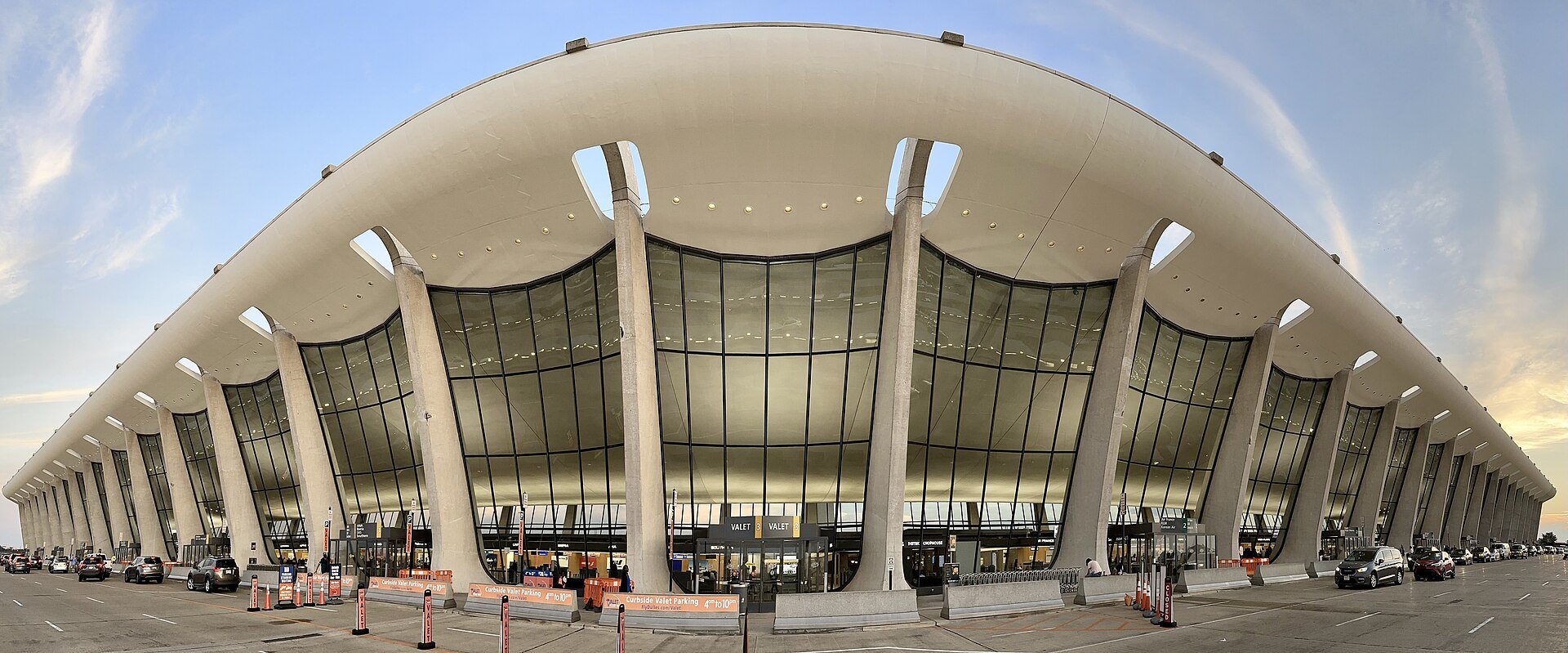
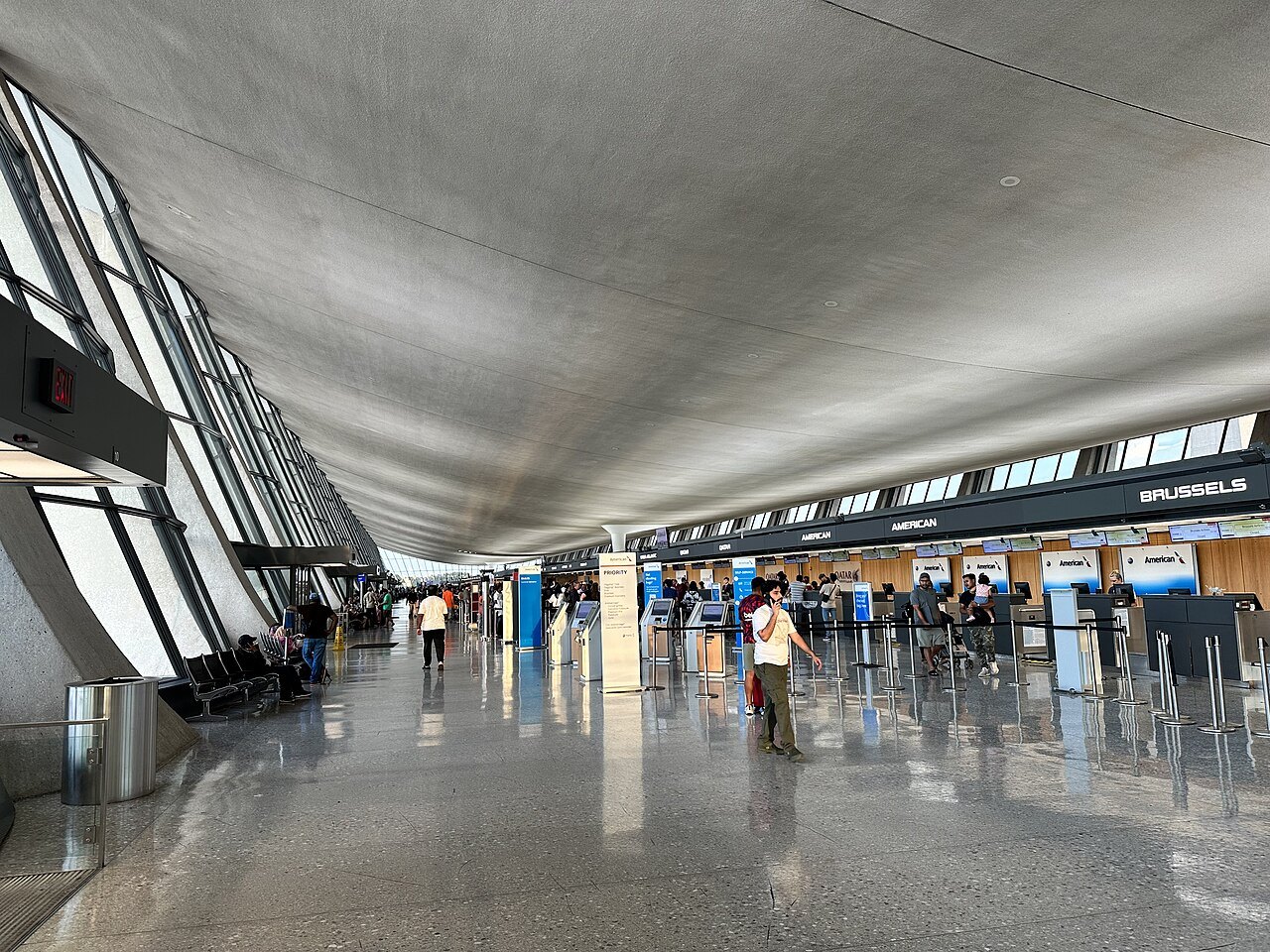
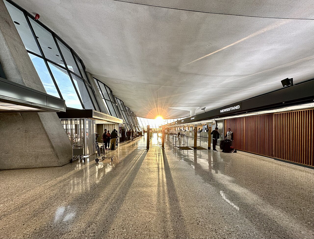
Dulles is the region's main international airport, and it was designed around an unusual idea. Eero Saarinen's main terminal of 1962, a great concrete roof slung between leaning columns, was built with no gates at all: passengers rode out to the planes in mobile lounges, buses that rose to the level of the aircraft doors. As Dulles grew into a hub, midfield concourses were built, and the lounges were joined first by an underground walkway to Concourse B and then, from 2010, by an underground train, the AeroTrain.
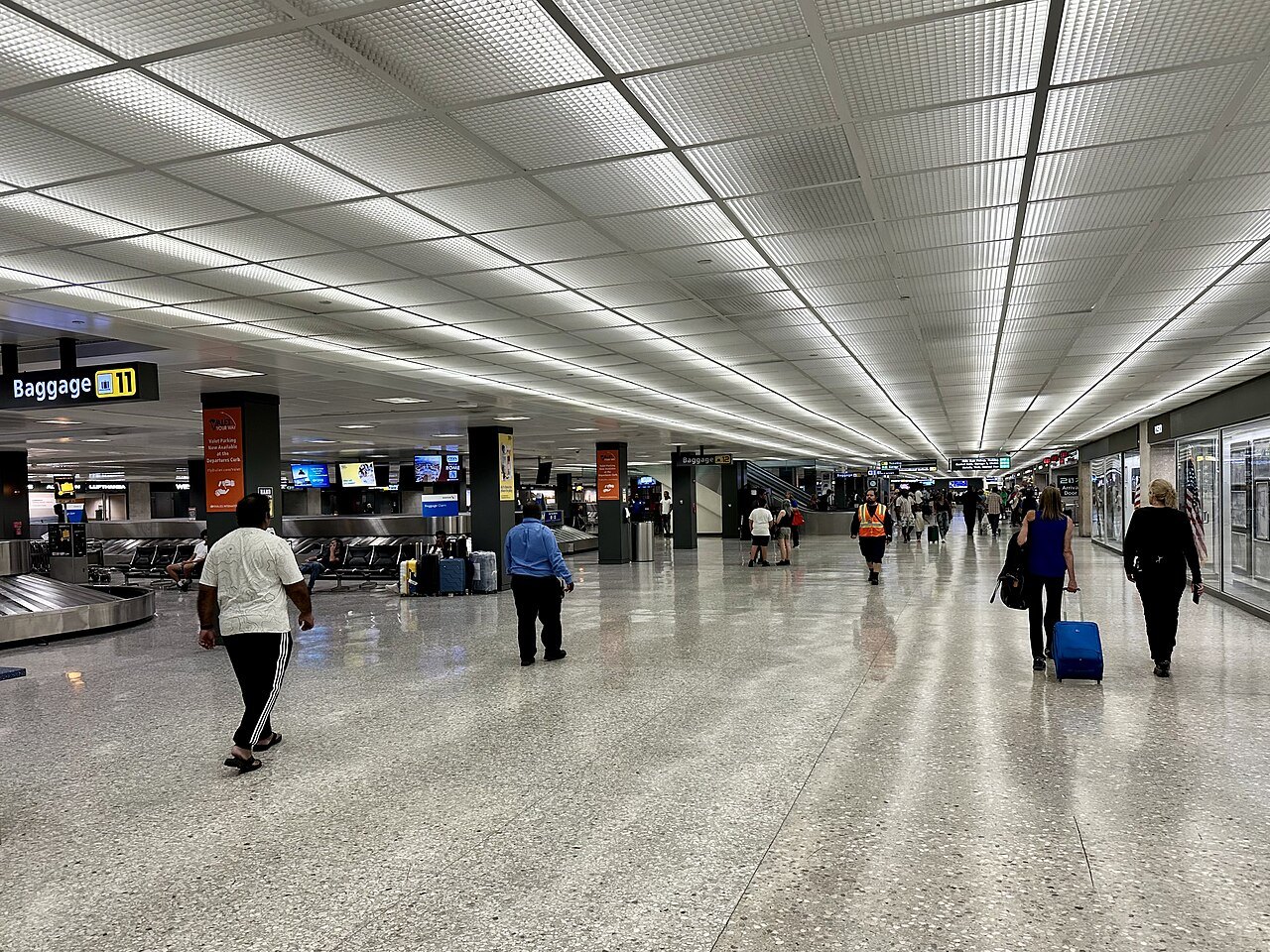
So on arrival you may reach the main terminal by walking, by AeroTrain or still, for some flights, by mobile lounge. International passengers go through immigration and customs first. Once you are in the main terminal with your bags, follow the signs for the Metro.
The Silver Line
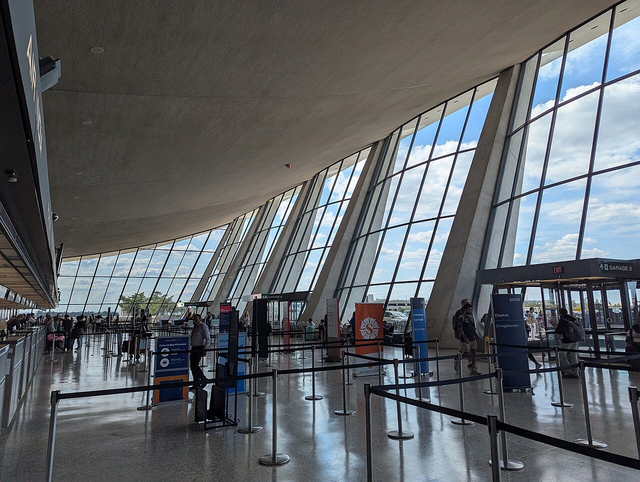
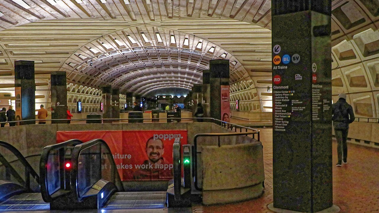
The Silver Line was built along the wide median strip that was left in the Dulles Access Road from the start, in the 1960s, for a future railroad. Its airport station stands a short distance from the terminal, reached by a pedestrian tunnel from the arrivals level, and the line then runs east through Reston, Tysons and Arlington, crosses the Potomac and passes under downtown Washington.
Pay by tapping a contactless bank card, a SmarTrip card or SmarTrip on your phone at the faregate, and tap again when you leave the system; SmarTrip cards are sold from machines at the station. The fare is by distance and time of day, and because the airport is at the far end of the line, it is among the longer trips on the system. Check the Metro's fare page for the current figure (see getting around).
Where to get off
No change is needed for the center. Trains toward the eastern end of the line pass through Rosslyn, then Foggy Bottom for the western memorials and the Kennedy Center, Farragut West for the White House, McPherson Square, Metro Center for downtown and Penn Quarter, and Federal Triangle and Smithsonian for the Mall, before L'Enfant Plaza and Capitol South.
For other parts of the city, change at Metro Center for the Red Line, to Union Station, Dupont Circle, Woodley Park or Cleveland Park, or at L'Enfant Plaza for the Green and Yellow Lines, to Navy Yard, Anacostia or the Wharf. Metro Center and L'Enfant Plaza both have elevators, which help with bags.
By road
Taxis and ride-hail cars wait at the terminal. The route follows the Dulles Access Road east, a federally owned highway built with the airport to connect it to the Capital Beltway, with a parallel toll road for other traffic, and then into the city across the Potomac. In light traffic the ride is not long; in the weekday rush hours, and on Friday afternoons, it can be very slow indeed, and the fare rises with it.
Renting a car at Dulles makes sense only if your trip is mostly outside the city, to the Virginia countryside, the Blue Ridge or the Udvar-Hazy Center, the Air and Space Museum's huge annex next to the airport. In Washington itself, parking is scarce and expensive, and a car is more burden than help (see getting here).
A stop on the way: the Udvar-Hazy Center
Next to the airport, in Chantilly, stands the Steven F. Udvar-Hazy Center, the annex of the National Air and Space Museum, opened in 2003 to hold the aircraft and spacecraft too large for the museum on the Mall. Its two vast hangars hold the Space Shuttle Discovery, the Enola Gay, a Concorde and an SR-71 Blackbird, and an observation tower looks out over the Dulles runways.
It is not on the Metro, so it is easiest with a car, a taxi from the terminal or a local bus from the Silver Line, and it makes most sense at the very start or end of a trip, with light luggage or a long layover in hand. Check its own page for the day's arrangements before you go, and see the Air and Space Museum page for the museum on the Mall.
Choosing
Take the Silver Line if you are traveling light or with a normal suitcase, if you are staying near a station on the line or an easy change from it, or if you land at a busy time on the roads. Take a taxi or ride-hail if you have a lot of luggage, small children or several people to split the fare, or if you arrive late at night, when trains are less frequent.
If you have a choice of airports, remember that Reagan National is much closer to the city and has its own Metro station on the Blue and Yellow Lines, but mostly handles domestic flights. For most international travelers Dulles is the gateway, and the Silver Line has made it a far easier one than it used to be.
Before you fly
Put the Metro's trip planner or a map app on your phone, check whether any weekend track work is planned on the Silver Line for your arrival day, and add SmarTrip to your phone's wallet before you land, so you can walk straight through the faregates. If you plan to use a bank card instead, check that it is contactless. And if you are arriving in the cherry blossom season or for a big event, book your hotel close to a Silver, Orange or Blue Line station to keep the ride simple.
Read next03
More from the journal
- Getting AroundHow does the Washington Metro work for visitors?The Metro has six colored lines, 98 stations and fares that depend on distance and time of day, so you tap in and tap out. How to pay, find the right platform, change lines and reach the sights, the airports and Union Station.Read the piece →
- The Tidal Basin and the Jefferson MemorialWhen do the cherry blossoms peak in Washington?Peak bloom at the Tidal Basin usually falls between the last week of March and the first week of April, but it has come as early as mid-March and as late as mid-April. What peak bloom means, how the Park Service forecasts it, and how to plan a trip around a date nobody knows in advance.Read the piece →
- The White House and Lafayette SquareHow do you get a White House tour?Public tours of the White House are free, self-guided and arranged only through a member of Congress, up to six months ahead, with a background check for older visitors. How the request works, what you see, and what to do if you cannot get one.Read the piece →